PUBLISHER: Published by Hydrographic Office of the Admiralty; Sold by J. D. Potter, agent for the Admiralty charts, 31 Poultry & 11 King St. Tower Hill.
MEDIUM: Engraving,
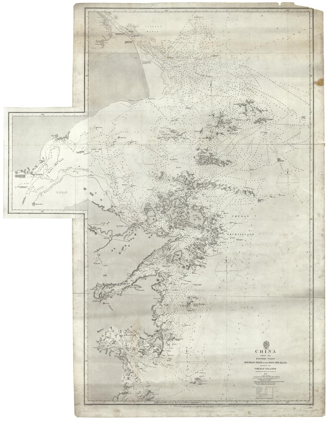
DATE: 1843, (1869).
EDITION SIZE: 42 3/8 x 24 5/8" (1066 x 627 mm) plus 8 1/2" folding panel & margins.
DESCRIPTION: A finely engraved sea chart of the coast of China. The folding panel shows the western sections of Hang-Chu Bay. The city of Shanghai is shown in the upper left. Engraved by J. & C. Walker. Working sea charts are inherently rare due to the nature of their use aboard ships. Although likely common when first made, the vast majority of them were either destroyed by use or destroyed intentionally when new updated versions were obtained.
ADDITIONAL INFO:
CONDITION: Some surface soiling and occasional minor stains. Three horizontal seams.Overall good condition for a working sea chart of the period. Light houses colored in red and yellow, otherwise uncolored.
REFERENCE:


 Login / Register
 Basket