The Old Print Shop

  • Home
  • Shop
  • Maps
  • Asia and its islands according to d'Anville; divided into empires, kingdoms, states, regions, &ca. with the European possessions and settlements in the East Indies and... all the discoveries made in the eastern parts by the English under Captn. Cook.

Asia and its islands according to d'Anville; divided into empires, kingdoms, states, regions, &ca. with the European possessions and settlements in the East Indies and... all the discoveries made in the eastern parts by the English under Captn. Cook.

  • ARTIST: Jean Baptiste Bourguignon Anville

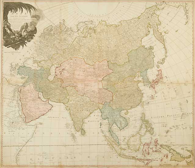
  • PUBLISHER: London Published by Laurie & Whittle, No. 53 Fleet Street 12th May, 1794.

  • MEDIUM: Copper plate engraving,

    DATE: 1794

  • EDITION SIZE: Joined four sheet map. 40 1/2 x 47" (103 x 119.5 cm) plus narrow margins.

  • DESCRIPTION: A handsome large scale map of Asia. Highly detailed, noting thousands of place names. The title cartouche depicts an arab merchant, his camel and trading goods.

  • ADDITIONAL INFO:

  • CONDITION: Good condition save for two tears in the lower left corner which have been professionally repaired. Full original body color.

  • REFERENCE:

  • CATEGORIES: Maps

Related Products