PUBLISHER: Published by Mount and Page, London.
MEDIUM: Copper plate engraving,
DATE: c. 1716.
EDITION SIZE: Image size 16 5/8 x 20 1/4" (423 x 517 mm).
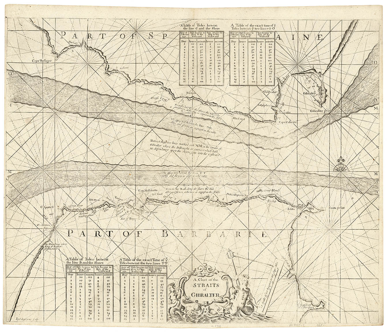
DESCRIPTION: Engraved by Joel Gascoyne. From "The English Pilot," the famous, ever-changing collection of English seacharts published in the late 17th and 18th centuries. This chart shows the tides running through the Straits of Gibraltar, between southern Spain and northern Africa. Tide tables appear at top and bottom.
ADDITIONAL INFO:
CONDITION: Very good condition; narrow side margins as issued.
REFERENCE:


 Login / Register
 Basket