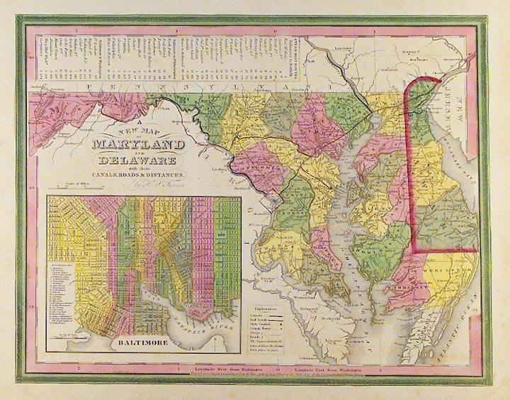
ARTIST: Henry Tanner
PUBLISHER: Published by Carey & Hart, Philadelphia.
MEDIUM: Engraving, handcolored,
DATE: 1844
EDITION SIZE: Image size 11 1/8 x 14 3/8" (28.2 x 36.2 cm).
DESCRIPTION: A good mid-century map of the state, with a large inset of Balitmore and a chart of steamboat routes between Baltimore and other cities.
ADDITIONAL INFO:
CONDITION: Good condition with original wash color save a couple of marginal spots.
REFERENCE:


 Login / Register
 Basket