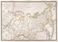
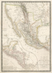
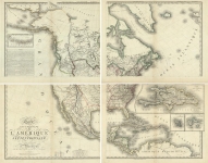
ARTIST: Adrien Hubert Brue
MEDIUM: Engraving,
DATE: 1826
EDITION SIZE: 14 1/4 x 19 7/8" (362 x 507 mm) plus margins.
DESCRIPTION: A well engraved map showing the political divisions in 1789. This map appeared in a deluxe, heavy paper edition of Brue's "Atlas universel de geographie physique, politique, ancienne & moderne."
ADDITIONAL INFO:
CONDITION: Good condition and color.
REFERENCE:


 Login / Register
 Basket