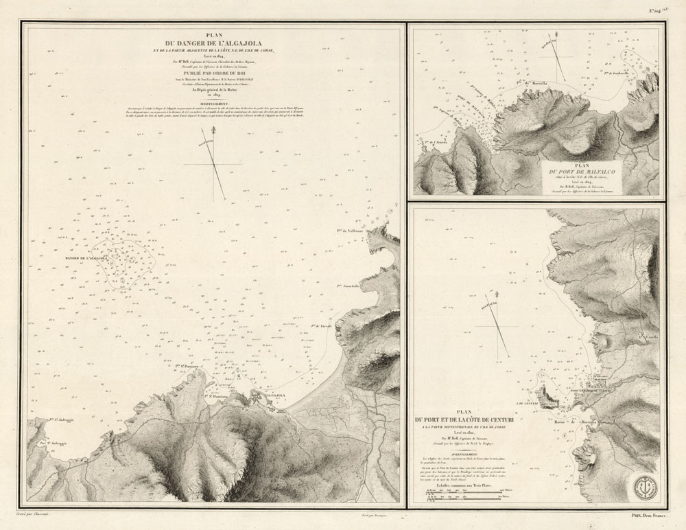
ARTIST: M. de Hell
PUBLISHER: Published by the Depot General de la Marine, Paris.
MEDIUM: Engraving,
DATE: 1829
EDITION SIZE: 17 3/4 x 23 1/2" (451 x 597 mm) plus margins.
DESCRIPTION: A scarce chart of three ports located on the northern coast on the island of Corsica. This chart appeared in "Pilote de l"Isle de Corse", published by the Depot de la Marine, Paris. Little is known about the French naval officer, M. de Hell. Engraved by Chassant.
ADDITIONAL INFO:
CONDITION: Good condition save for tear in right margin. Black & white.
REFERENCE:


 Login / Register
 Basket