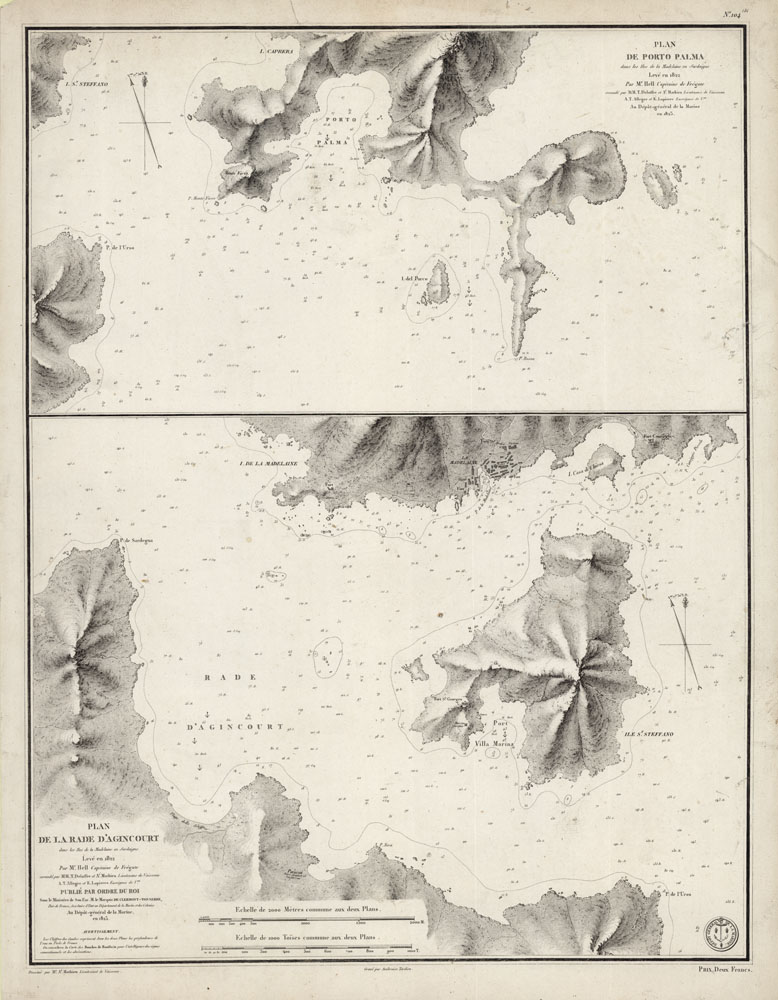
ARTIST: M. de Hell
PUBLISHER: Published by the Depot General de la Marine, Paris.
MEDIUM: Engraving,
DATE: 1824
EDITION SIZE: 18 1/4 x 23 5/8" (463 x 599 mm) plus margins.
DESCRIPTION: A scarce chart of two ports on the island of Sardinia. This chart appeared in "Neptune de la Mediterranee", published by the Depot de la Marine, Paris. Little is known about the French naval officer, M. de Hell. Engraved by Tardieu.
ADDITIONAL INFO:
CONDITION: Good condition save for several tine holes within the map. Small repaired split in upper map. Black & white.
REFERENCE:


 Login / Register
 Basket