MEDIUM: Copper plate engraving,
DATE: 1777
EDITION SIZE: Image size, 14 7/8 x 16 3/8" (379 x 417 mm) plus margins.
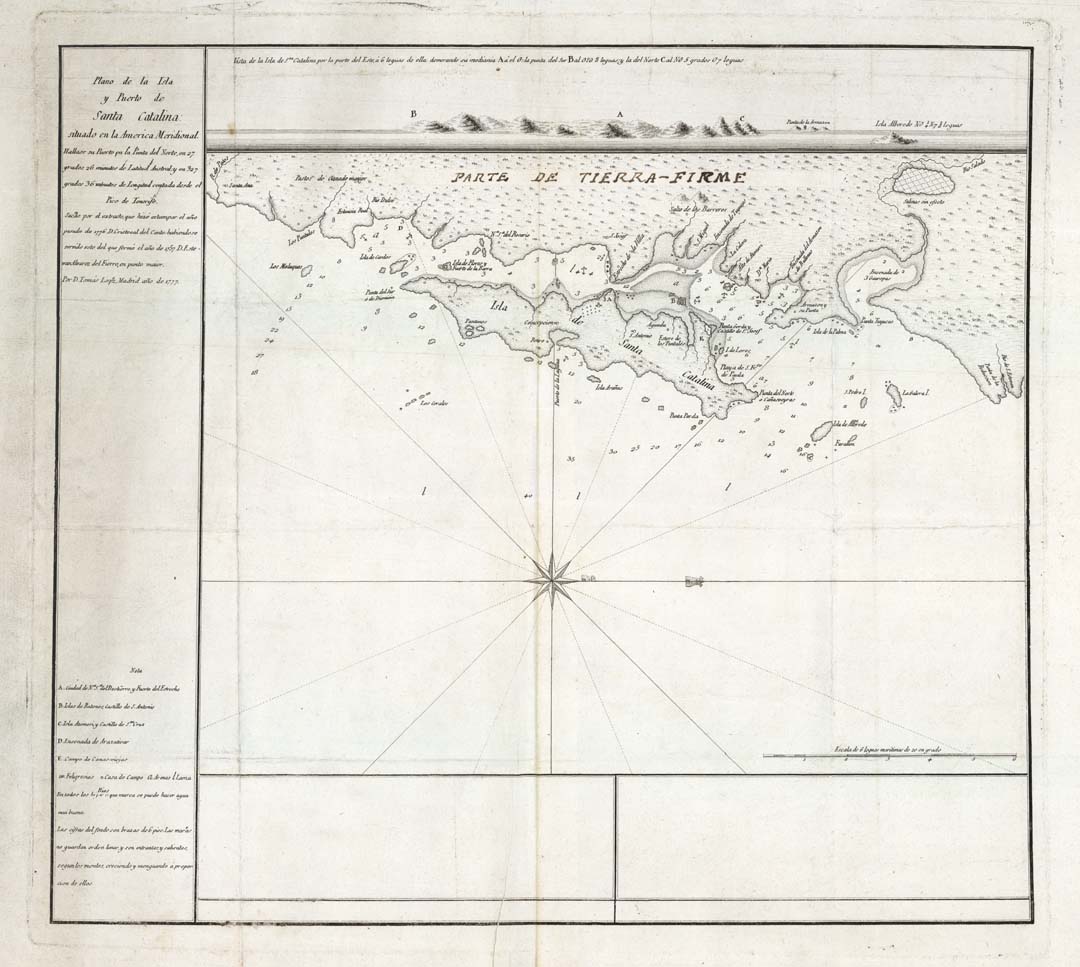
DESCRIPTION: A rare separately issued chart of Santa Catarina Island. This resort island is located off the southern coastline of Brazil. A lettered key identifying six different points of interest. Gives soundings, anchorages, topography and other details. Tomas Lopez, was the official cartographer to the King of Spain during the second half of the eighteenth century.
ADDITIONAL INFO: Manuscript title of "Parte de Tierra-Firme" on mainland. Area where this is written was masked off during the printing process leaving a 1/4 x 7 1/2" strip.
CONDITION: Good condition. Black & white
REFERENCE:


 Login / Register
 Basket