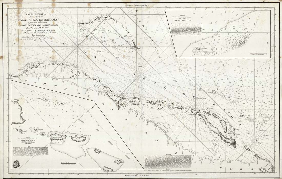
ARTIST: Juan de Langara
PUBLISHER: Published by Deposito Hidrografico de Marina, Madrid.
MEDIUM: Copper plate engraving,
DATE: 1799
EDITION SIZE: 24 x 37 1/4" (61 x 94.5 cm) plus margins.
DESCRIPTION: This scarce Spanish chart shows the northern coast of Cuba with the many atolls and islands to the north and along the Old Bahama Channel. Insets: "Plano del fondeadero que forman los cayos de piedras, mono, monillo, y adyacentes" and "Plano del fondeadero que forman los cayos verde y confites." The map was commissioned by the King's secretary of state and navy, Don Juan de Langara, who is noted for his role in the mapping the Gulf Coast in the same year. Relief shown by hachure, Depth by soundings.
ADDITIONAL INFO:
CONDITION: Good condition save for some water staining in the upper left corner. Not uncommon issues with working sea charts.
REFERENCE:


 Login / Register
 Basket