MEDIUM: Copper plate engraving,
DATE: 1781
EDITION SIZE: Image size, 14 1/4 x 15 1/2" (363 x 392 mm) plus margins.
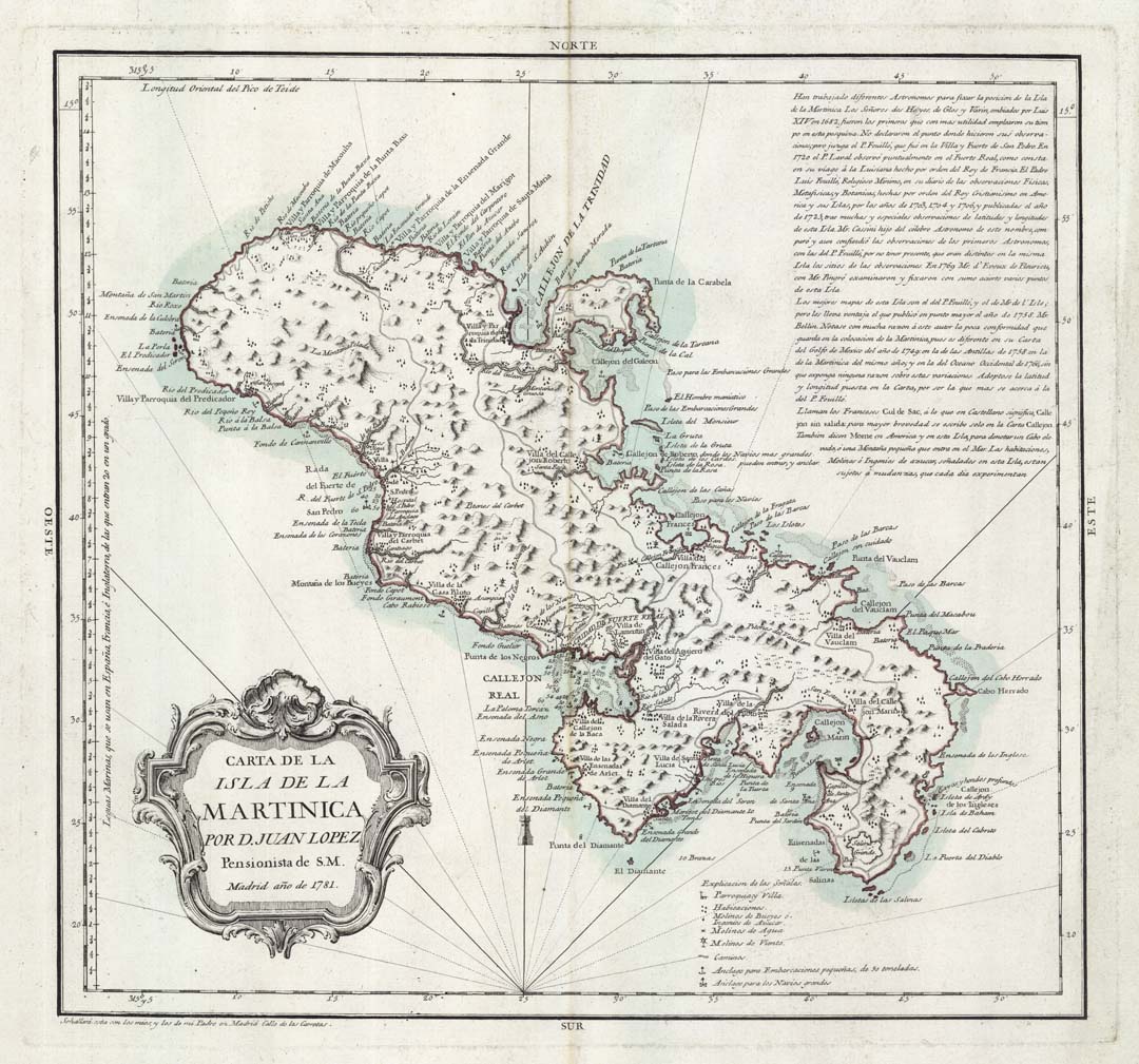
DESCRIPTION: A rare separately issued chart of the Island of Martinique. This map is highly detailed noting towns, villages, roads, windmills and rivers. Tomas Lopez, was the official cartographer to the King of Spain during the second half of the eighteenth-century.
ADDITIONAL INFO:
CONDITION: Very good condition. Original outline hand coloring.
REFERENCE:


 Login / Register
 Basket