ARTIST: Pieter van den Keere
PUBLISHER: Published by Joannes Jansonius, Amsterdam.
MEDIUM: Copper-plate engraving, handcolored,
DATE: 1608 - c.1630.
EDITION SIZE: Image size 15 3/4 x 21 3/16" (40 x 53.9 cm).
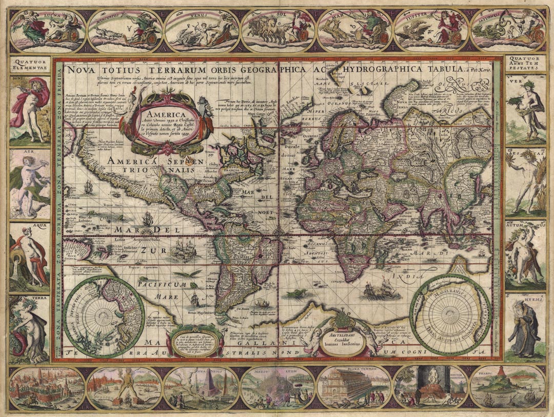
DESCRIPTION: A classic example of a world map based on Mercator's projection. This beautiful carte-a-figures map of the world was based on Blaeu's almost identical map that was issued in 1606. Some of the engraved ornamentations include allegorical representations of the Sun, Moon, and the five known planets. Down the sides are, on the left, four panels illustrating the elements and, on the right, the four seasons. Along the bottom are seven vignettes showing the Seven Wonders of the World. Geographically, the map is largely copied from Blaeu but includes more legends and additions referring to explorations in the Arctic. A long note near the cartouche discusses the theory that the straits of Anian and Davis link to form a Northwest Passage. Also added are rhumb lines radiating from three compass roses arrayed along the equator. The map was first published in 1608. In 1621 Kaerius sold his plates to Jan Jansson who then issued the map with his imprint. This example is the fourth state with Jansson's imprint and no date. A scarce map.
ADDITIONAL INFO: German text on verso. Framed in 1 1/4" wood molding painted black with gold metal leaf lip. 8-ply rag stock mat and rag stock backing. Finished in UV Plexiglass.
CONDITION: Overall in good condition. Some repaired splitting along lower centerfold and a tiny repaired hole just above the Black Sea. There are several small chips and tears in the outer margins. All have been professionally repaired. Original handcoloring with some minor modern enhancements.
REFERENCE: Shirley, Mapping of the World #264.


 Login / Register
 Basket