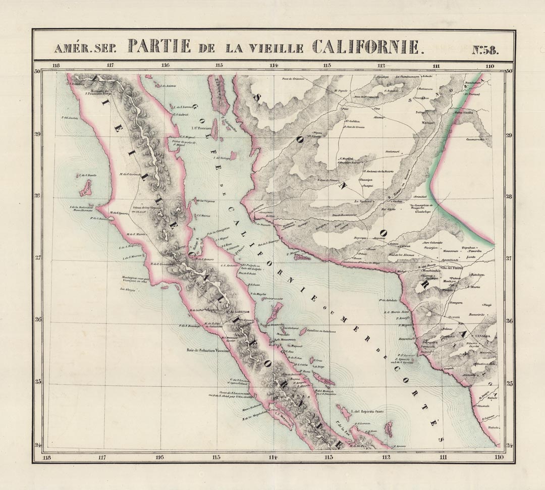
ARTIST: Philippe Vandermaelen
PUBLISHER: Published by P. Vandermaelen, Belgium.
MEDIUM: Lithograph handcolored,
DATE: 1827
EDITION SIZE: Image size 18 1/4 x 20 1/8" (464 x 511 mm) plus margins.
DESCRIPTION: A beautiful and well detailed map of a portion of the central portion of the Baja peninsula and northwestern Mexican mainland. Shows an area from Isle Redonda to just south of Santa Margarita Island in the Pacific and Tiberon Island to Cerralbo and P. Arenas in the Sea of Cortez. Plate No. 58 from "Atlas Universelle” The first commercial atlas printed using lithography as the printing medium.
ADDITIONAL INFO:
CONDITION: Very good condition. Original outline hand coloring.
REFERENCE:


 Login / Register
 Basket