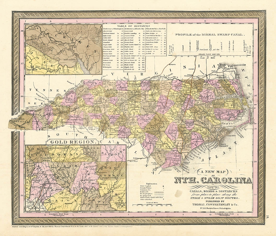
ARTIST: Samuel Augustus Mitchell
PUBLISHER: Published by Thomas, Cowperthwait & Co. Philadelphia.
MEDIUM: Engraving, hand colored,,
DATE: 1850-55.
EDITION SIZE: Image size 11 1/4 x 13 7/8" (28.5 x 35 cm).
DESCRIPTION: A fine map from Cowperthwait edition of Mitchell's "A New Universal Atlas containing maps of the various Empires, Kingdoms, States and Republics of the World". There is a large, detailed inset map of the "Gold Region" in the western part of the state between the Great Catawba and Yadkin rivers. This feature is not seen in most editions of the atlas. A smaller inset of the New Bern area, a table of distance chart and a profile of the Dismal Swamp canal are also shown.
ADDITIONAL INFO:
CONDITION: Good condition and color.
REFERENCE: Phillips, Atlases, 6103.


 Login / Register
 Basket