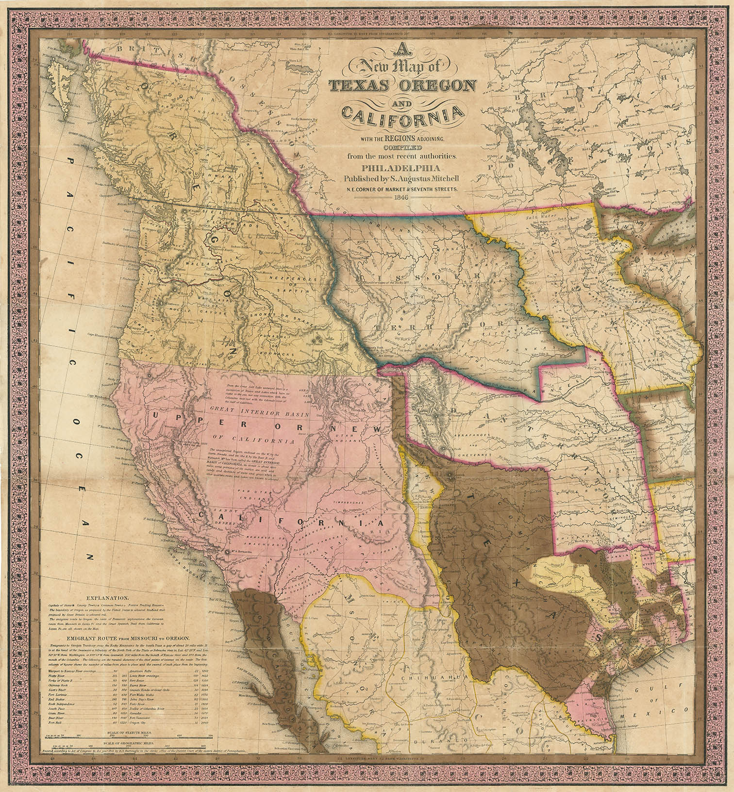
ARTIST: Samuel Augustus Mitchell
PUBLISHER: Published by S.A. Mitchell, Philadelphia.
MEDIUM: Handcolored engraving,
DATE: 1845-46.
EDITION SIZE: Image size 22 x 20 1/2" (55.9 x 52 cm).
DESCRIPTION: One of the great pocket maps of the American West.<br><br> Wheat writes: "This map represents a great step forward, in that it was among the first by a commercial cartographer to utilize the recent explorations. . . ." <br><br> The newly formed state of Texas is shown with its "stove-pipe" configuration, claiming the lands of the upper Rio Grande. These claims were eventually given up as part of the Great Compromise of 1850, in exchange for the U.S. Federal Government's assumption of Texas' public debt.<br><br> Mitchell based this map on works of Arrowsmith, Nicollet, Wilkes and Fremont. The popularity of this map was likely enhanced by the Mexican-American War which commenced the year the map was issued.<br><br>
ADDITIONAL INFO: Retains but removed from original covers.
CONDITION: Very good condition, save for some minor fold splits with occasional very small losses along fold intersections. Backed on rice paper. Full original handcoloring. Overall, a very clean, sound ,and bright impression of this map.
REFERENCE: Martin & Martin. Pl. 36, pp. 134-35; Wheat, v. 3, p. 35.


 Login / Register
 Basket