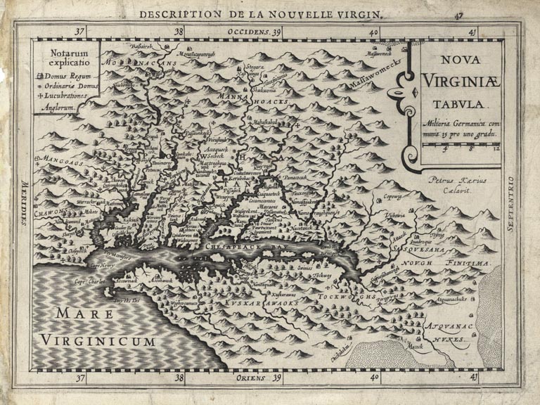
ARTIST: Johannes Cloppenburg
MEDIUM: Copper plate engraving,
DATE: 1630.
EDITION SIZE: 7 1/4 x 10" (18.4 x 25.5 cm) plus margins.
DESCRIPTION: This is an uncommon map which was included in a reduced sized series of the Mercator-Hondius "Atlas sive Cosmographicae." West is oriented at the top with the whole of Chesapeake Bay dominating the central part of the plate. Relief is shown pictorially with a large amount of internal detail. It was engraved by Pieter van der Keere. It is the fourth derivative map from John Smith's landmark map of Virginia produced in 1612. A scarce map.
ADDITIONAL INFO: Plate 47 & a French text edition. Either from the 1st edition issued in 1630 or 3rd issued 1636.
CONDITION: Good condition save for some short tears along sheet edge.. One tear into image in lower right. B/W.
REFERENCE: Burden, P. "Mapping of North America" #226.


 Login / Register
 Basket