ARTIST: Samuel Lewis
PUBLISHER: Published by C. P. Wayne, Philadelphia.
MEDIUM: Copper plate engraving,
DATE: 1806.
EDITION SIZE: Image size 9 3/4 x 15 1/4" (25 x 28.8 cm) plus margins.
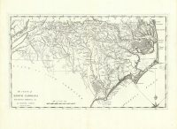
DESCRIPTION: A fine map from the American edition of John Marshall's "Life of George Washington." This work, long the standard biography on Washington, was immensely popular. Editions were published in America, England, France, Germany, and Holland. This "history" of Washington was accompanied by an atlas of ten maps of the campaigns of the American Revolution. This map depicts the campaigns and encampments found between Elk Head in Maryland and Monmouth in New Jersey. Drawn by S. Lewis from surveys made by orders of G. Washington. Engraved J. H. Seymour.
ADDITIONAL INFO:
CONDITION: Good condition save for minor offsetting. Soft matline well away from image. Black & white.
REFERENCE:


 Login / Register
 Basket