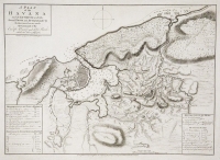
ARTIST: Thomas Kitchin
MEDIUM: Copper plate engraving.
DATE: c. 1770.
EDITION SIZE: Image size 13 3/8 x 14 1/4" (340 x 364 mm) plus margins.
DESCRIPTION: Engraved for "Guthries New Geographical Grammar". Published London. In the aftermath of the French and Indian War (1756-1763), England and its American colonies started disagreeing on future growth. Fast increasing in population, and needing more land for settlement, various colonies claimed the right to extend their boundaries as far west as the Mississippi River. In the Pacific Northwest, the Straits of Juan de Fuca open up to a huge, but undefined, Western Sea. The River of the West conjecturally flows from Pikes Lake in the Intermountain West. New Albion and the Snowy Mountains are prominently shown, but the western region is mostly left open to the imagination.
ADDITIONAL INFO:
CONDITION: Good condition. Backed on rice paper. B/W
REFERENCE:


 Login / Register
 Basket