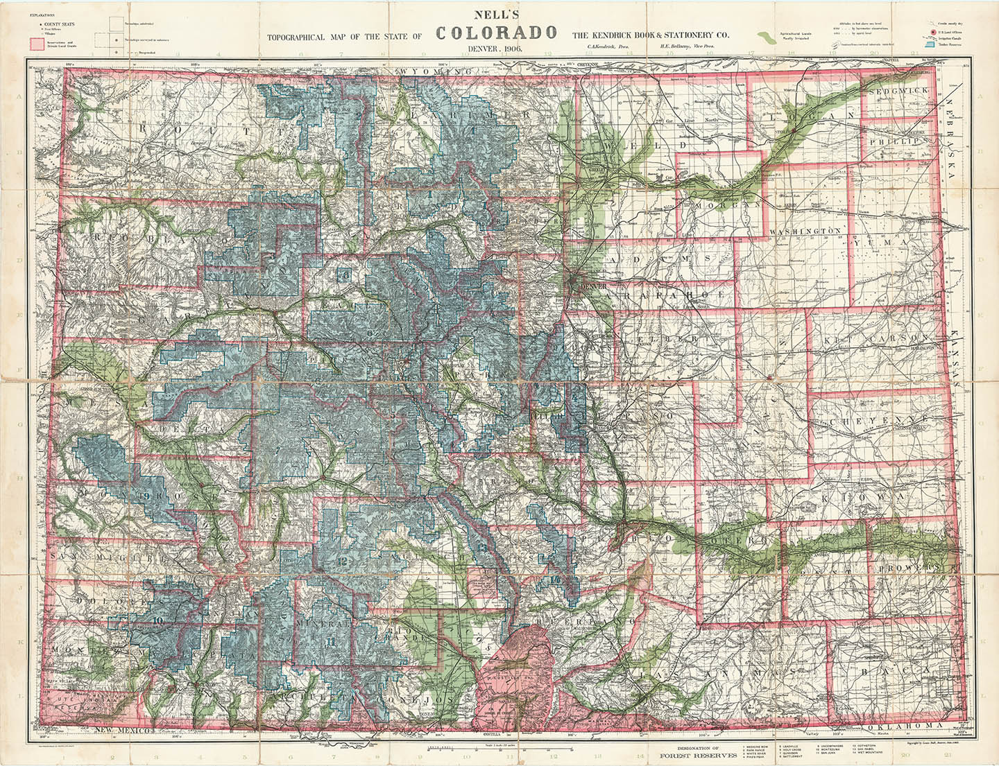
ARTIST: Louis Nell
PUBLISHER: Published by the Kendrick Book & Stationery Co.
MEDIUM: Wax lithograph,
DATE: 1906.
EDITION SIZE: Folding pocket map. 28 5/8 x 39 1/4" (72.5 x 99.7 cm) plus upper title and margins.
DESCRIPTION: A fine 1906 edition of Nell's Map of Colorado. Nell's Map was first issued in 1880 and updated yearly thereafter. It is the most important and detailed sequence of Maps of Colorado issued in the latter half of the 19th and early 20th centuries. The map is highly detailed, giving geographical and topographical information along with cities, towns, wagon roads, trails and railroads, existing and proposed.
ADDITIONAL INFO: Folding pocket map bound into original covers. Contains twelve-page descriptive index.
CONDITION: Good condition, save for occasional minor fold split. Original color.
REFERENCE:


 Login / Register
 Basket