PUBLISHER: Published by J. L. Smith, 27 South Sixth St. Philadelphia.
MEDIUM: Stone engraving,
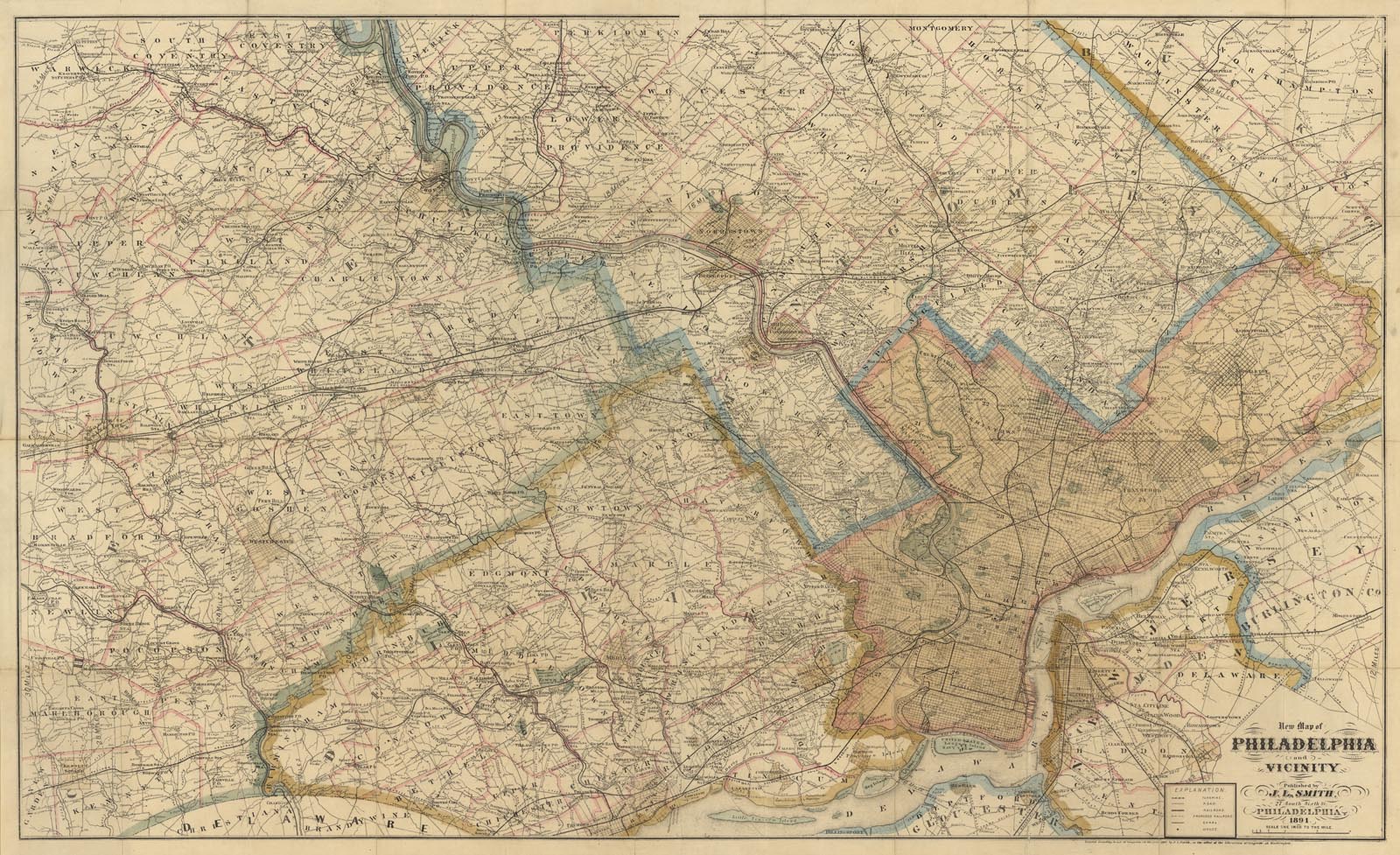
DATE: 1891
EDITION SIZE: Image size 26 x 43" (66.2 x 190 cm) plus margins.
DESCRIPTION: A large, highly detailed segmented pocket map. Drawn on a scale of one inch to the mile. Shows an area from Philadelphia and as as far north as North Wales and Hartsville, east to Moorestown, NJ and to the west to just beyond Downingtown and Kennett Square. Retains original green cloth covers with gilt stamped title, "Smith's Map of Philadelphia and Vicinity."
ADDITIONAL INFO:
CONDITION: Good condition, Printed outline color.
REFERENCE:


 Login / Register
 Basket