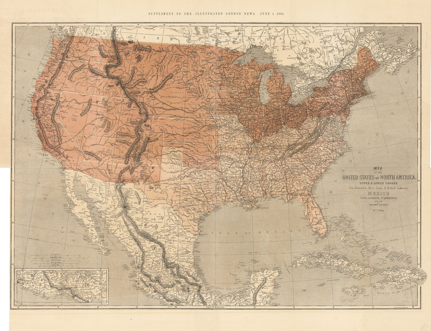
ARTIST: Theodor Ettling
PUBLISHER: Published by the Illustrated London News.
MEDIUM: Lithograph, printed in three colors.
DATE: 1861.
EDITION SIZE: Segmented pocket map, overall 26 3/4 x 39 3/8" (67.7 x 100.2 cm)
DESCRIPTION: Unusual Civil War map of the United States. The map is color-coded to show the division between the United States & Confederacy at the onset of the American Civil War. The border states of Missouri, Kentucky and Maryland are noted as being as part of the South. In the West, the proposed Arizona Territory is shown south of New Mexico. Nevada is shown with an early proposed boundary with Utah, and both Washington and Oregon are shown with their eastern boundaries in the Rocky Mountains. This map appeared as a supplement to The Illustrated London News.
ADDITIONAL INFO:
CONDITION: Good condition.
REFERENCE:


 Login / Register
 Basket