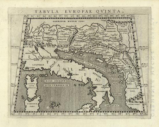
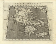
ARTIST: Claudius Ptolemy
PUBLISHER: Published by Giovanni Antonio Magini, Venice.
MEDIUM: Copper plate engraving,
DATE: 1596
EDITION SIZE: Plate size 5 3/8 x 7" (13.5 x 17.8 cm) plus margins.
DESCRIPTION: A fine example of this Ptolemaic map of the Adriatic, Italy and the Balkans. This map appeared in "Geographiae Cl. Ptolemaei Pars Scounda" which was part of "Geographiae Universae...".
ADDITIONAL INFO:
CONDITION: Good condition. Black & white.
REFERENCE:


 Login / Register
 Basket