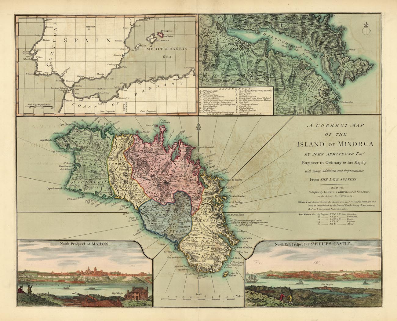
ARTIST: John Armstrong
PUBLISHER: Published by Laurie & Whittle, No. 53 Fleet St. London.
MEDIUM: Copper plate engraving.
DATE: 1794.
EDITION SIZE: Image 17 1/2 x 21 3/4" (44.5 x 55.2 cm) plus margins.
DESCRIPTION: A fine map of the Balearic Island of Minorica. Extremely detailed, many cities, towns and roads are clearly marked. Four insets enhance this map, an overview of the western Mediterranean showing the location of the island. A close up map of the city and harbor of Mahon, and two views, a "North Prospect of Mahon" and "North East Prospect of St. Philips Castle." A note below the title give a brief history::"Minorca was Conquered upon the Spaniards in 1708 by General Stanhope, and ceded to Great Britain by the Peace of Utrecht in 1713. It was taken by the French in 1756, and restored in 1763."This map appeared in Thomas Kitchen's "A New Universal Atlas Exhibiting all the Empires, Kingdoms, States, Republics, &c. &c. in the Whole World."
ADDITIONAL INFO:
CONDITION: Good condition save for tiny hole in the upper left. Original outline hand coloring.
REFERENCE:


 Login / Register
 Basket