ARTIST: William Bridges
PUBLISHER: Published by Isaac Riley, New York, 1807.
MEDIUM: Copper plate engraving
DATE: 1807.
EDITION SIZE: Image size 12 1/8 x 12 3/4 (30.6 x 32.4 cm) plus margins.
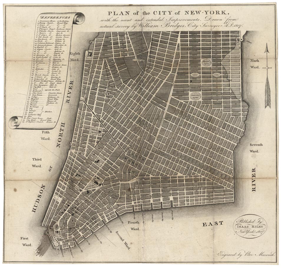
DESCRIPTION: William Bridges, a city surveyor, published this map of old New York based on what was known as the Mangin-Goerck Plan. The Mangin-Goerck plan is one of the most fascinating of all printed plans of New York. It was primarily the work of Joseph Mangin, the accomplished architect who was responsible for the design of City Hall. In December of 1797, the City of New York contracted Mangin, along with surveyor Casimir Goerck, to compile a new map of the city for official use. The extraordinary growth of New York meant that most existing maps of the city quickly became obsolete. Mangin and Goerck were hired to construct an updated plan that would include all existing streets and buildings, and include the names of the owners. But shortly after beginning the commission, Goerck died, and for the next six years, Mangin worked secretly on the map by himself. In November of 1803, his map was unveiled to the City Commissioners, who were shocked by what they saw. Instead of producing an accurate map of the existing topography and streets, Mangin had taken the liberty of making his own plan for the city’s future. Mangin’s plan was rejected. Bridges later published John Randel, Jr.'s “Commissioner's Plan” in 1811, the master plan of the gridiron layout of the streets of upper Manhattan.
ADDITIONAL INFO:
CONDITION: Fair to good condition. Splitting along fold lines. Some minor loss in upper fold intersection.
REFERENCE: Augustyn-Cohen "Manhattan in maps" pp.98-99; Haskell, D.C. "Manhattan maps", 642


 Login / Register
 Basket