ARTIST: John Entick
MEDIUM: Copper plate engraving,
DATE: c.1764.
EDITION SIZE: Image size 7 5/8 x 9" (19.5 x 23 cm) plus margins.
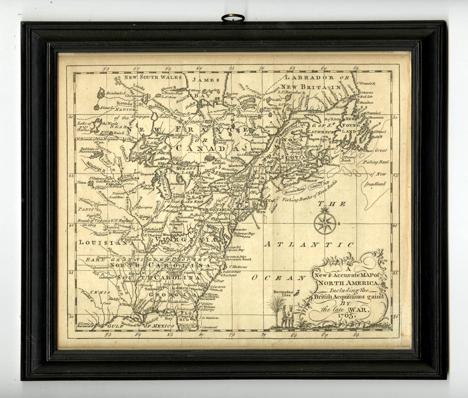
DESCRIPTION: Scarce map of the eastern part of North America from James Bay to the Gulf of Mexico in the year 1763. It shows boundaries, colonies, towns, cities, forts, and Indian tribal territory. Earl Granville's Property (North Carolina) is shown to extend past the Mississippi to the western edge of the map. This map appeared in Published in John Entick's"The General History of the Late War". A very scarce work. <br><br>
ADDITIONAL INFO: Framed.
CONDITION: Good condition. B/W
REFERENCE:


 Login / Register
 Basket