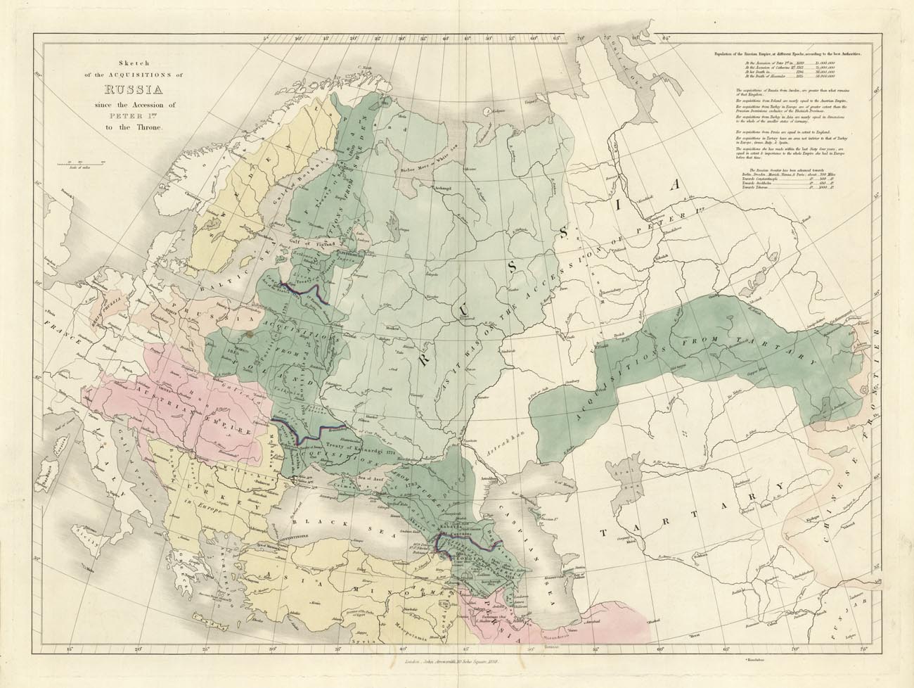
ARTIST: John Arrowsmith
PUBLISHER: Published by John Arrowsmith, London.
MEDIUM: Engraving,
DATE: 1838.
EDITION SIZE: 17 3/8 x 23 3/4" (44 x 60.2 cm) plus margins.
DESCRIPTION: This map is from "The London Atlas of Universal Geography, Exhibiting the Physical & Political Divisions of the Various Countries of the World,… The darker green areas show the "Acquisitions" of lands from various countries. An interesting and detailed map
ADDITIONAL INFO:
CONDITION: Good condition. Original hand coloring.
REFERENCE:


 Login / Register
 Basket