PUBLISHER: U.S. War Department's Atlas to Accompany the Official Records of the Union and Confederate Armies. Washington: Gov't. Printing Office, 1891-95. Printed by Julius Bien & Co.
MEDIUM: Multi-stone lithograph,
DATE: 1891-95.
EDITION SIZE: Image size 16 3/8 x 27 1/8" (41.7 x 68.8 cm).
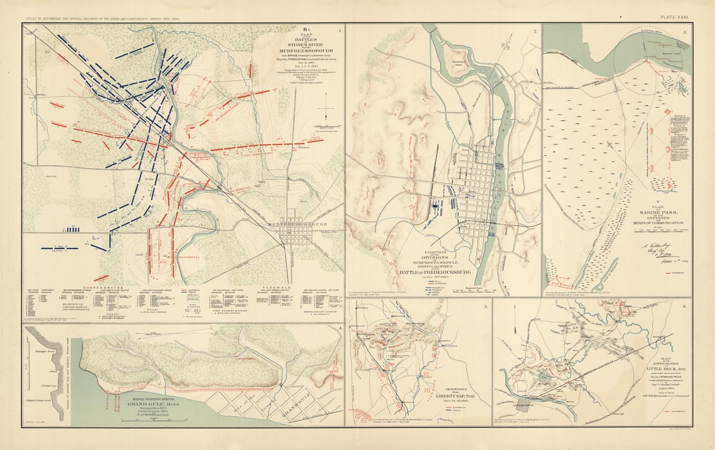
DESCRIPTION: Additional titles for the map segments include - Positions of the divisions of Humphreysm Whipple, Griffin and Sykes at the Battle of Fredericksburg ; Plan of Sabine Pass ; Map of the approaches to Little, Rock, Ark. <br><br> This map appeared in the United States War Department's "Atlas to Accompany the Official Records of the Union and Confederate Armies." Richard Stephenson in his book "Civil War Maps" wrote, "This is the most detailed atlas yet published on the Civil War. It consists of reproductions of maps compiled by both Union and Confederate soldiers." The maps is this publication are greatly detailed showing topography, troop placements and movements, and other information that deals with the Civil War.
ADDITIONAL INFO:
CONDITION: Good condition, save for minor discoloration.
REFERENCE: LC, Civil War maps (2nd ed.), 99.


 Login / Register
 Basket