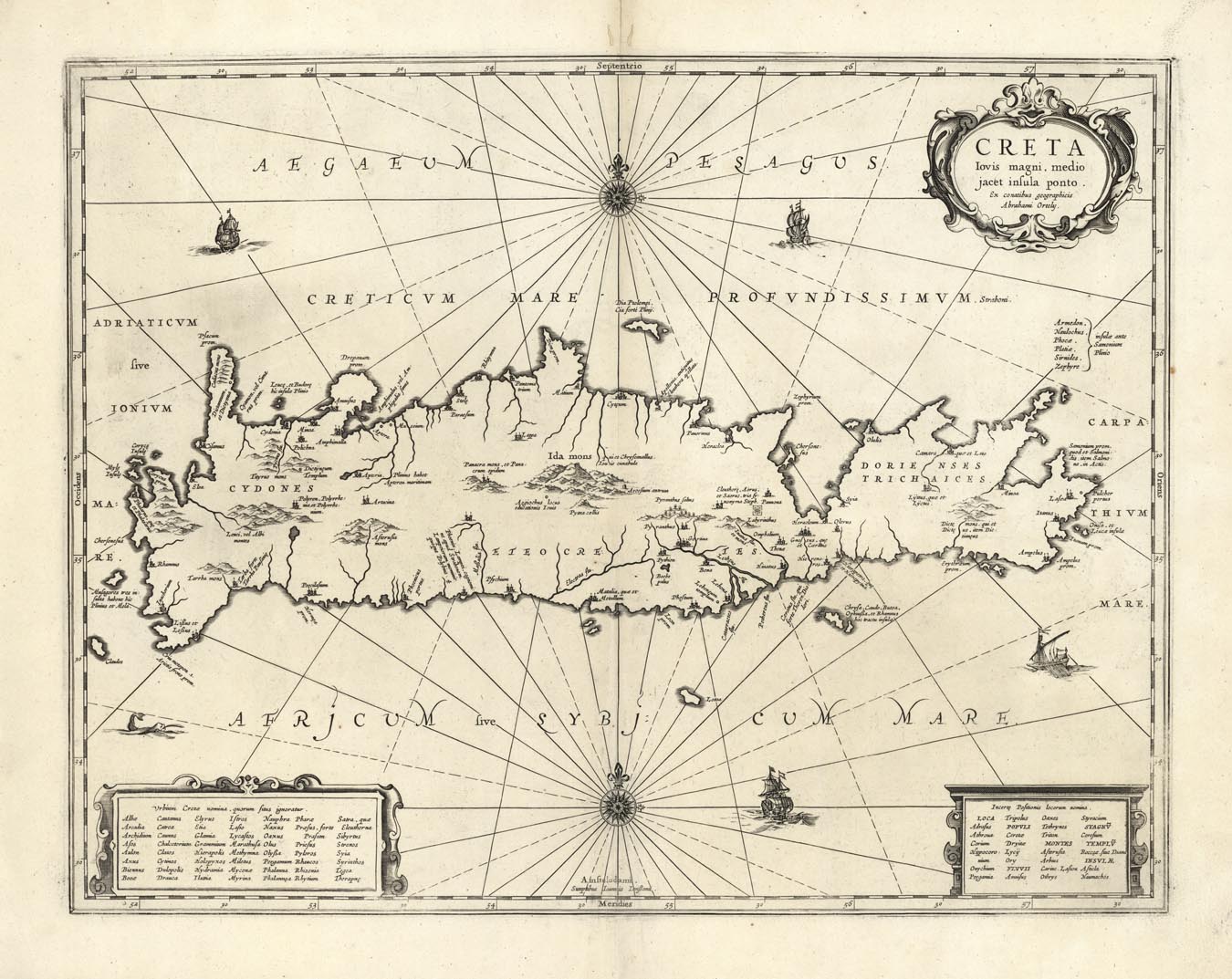
ARTIST: Abraham Ortelius
PUBLISHER: Published by Johannes Janssonius, Amsterdam
MEDIUM: Copper plate engraving,
DATE: c.1660.
EDITION SIZE: 14 7/8 x 19 1/8"(37.7 x 48.5 cm) plus margins.
DESCRIPTION: A map of ancient Crete that was taken from Abraham Ortelius' map of Crete (Van den Brocke #217). This map appeared in Jansson's historical atlas.
ADDITIONAL INFO: Blank verso
CONDITION: Good condition save for some repaired worm holes in the upper margin and minor splitting along upper and lower centerfold. B/W
REFERENCE:


 Login / Register
 Basket