ARTIST: J. Russell
PUBLISHER: Published by H. D. Symonds, London.
MEDIUM: Copper engraving,
DATE: 1794-95.
EDITION SIZE: Image size 14 7/8 x 17 1/2" (37.8 x 44.5 cm).
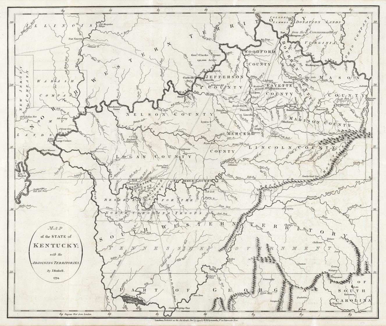
DESCRIPTION: Important early map of Kentucky and the region between the Ohio and Tennessee Rivers from William Winterbotham"s "An Historical View of the United States." It was the basis for Reid's 1795 map. This maps shows Kentucky, a portion of the Northwestern and Southwestern Territories and the Tennessee Government. North and west of the Ohio River the military tracts are noted. They are, New Jersey Company, Wabash Company, Army Lands. North of Louisville is Genl. Clarks Grant of 150,000 Acres. Also notes the utopian but nonexistent towns of Lystra and Franklinville. Lexington, Louisville, Knoxville, Nashville and Clarksville all appear. Shows many forts, traces, trails, etc.
ADDITIONAL INFO:
CONDITION: Good condition. B/W
REFERENCE: cf. Wheat & Brun 647. Howes, U.S.iana, W581. Phillips, Maps, p. 35.


 Login / Register
 Basket