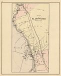
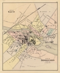
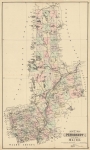
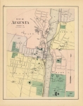
ARTIST: George Colby
PUBLISHER: Published by George N. Colby, Houlton, Maine.
MEDIUM: Hand colored stone engraving.
DATE: 1885
EDITION SIZE: 15 1/8 x 12 1/2" (38.5 x 31.5) plus margins.
DESCRIPTION: A fine map of the popular summer resort area. Drawn on a scale of 4 miles to the inch. From Colby's "Atlas of the State of Maine".Shows an area from the northern portion of Millinoeket Lake to Scopan Lake.
ADDITIONAL INFO:
CONDITION: Good condition and color save for a minor damp stain in the lower edge,
REFERENCE:


 Login / Register
 Basket