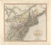
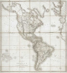
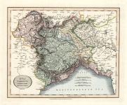
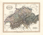
ARTIST: John Cary
PUBLISHER: Published by John Cary, engraver & map seller, 181 Strand, London.
MEDIUM: Engraving, hand colored,
DATE: 1801-08.
EDITION SIZE: 18 x 20 1/4" (45.6 x 51.6 cm) plus margins.
DESCRIPTION: A nicely detailed and beautifully colored map of these two countries. Includes the islands of Minorca, Majorca and Ibiza, parts of northern Africa, and southern France. Highly detailed with color coding according to region. Appeared in Cary's New Universal Atlas.
ADDITIONAL INFO:
CONDITION: Good condition. Full original hand coloring.
REFERENCE:


 Login / Register
 Basket