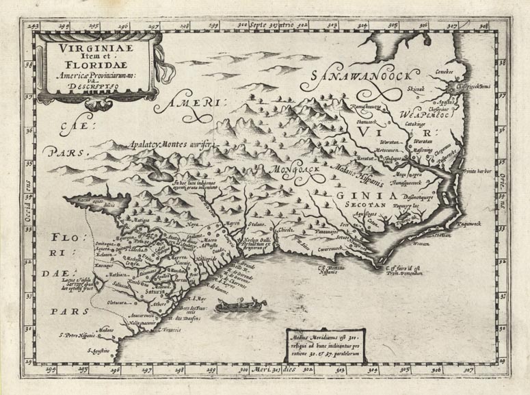
ARTIST: Johannes Cloppenburg
MEDIUM: Copper plate engraving,
DATE: 1630 (1673)
EDITION SIZE: 7 3/8 x 10" (18.6 x 25.3 cm) plus margins.
DESCRIPTION: This is the rare second state of Cloppenberg' map of the Southeast. Shows an area from St. Augustine to just north of a rather strangle shaped Chesapeake Bay. The cartographic information on this map is largely derived from John White's map of Virginia and Jacques le Moyne's map of Florida. The second state lacks the engraved sea.
ADDITIONAL INFO:
CONDITION: Good condition. B/W
REFERENCE: Burden #227


 Login / Register
 Basket