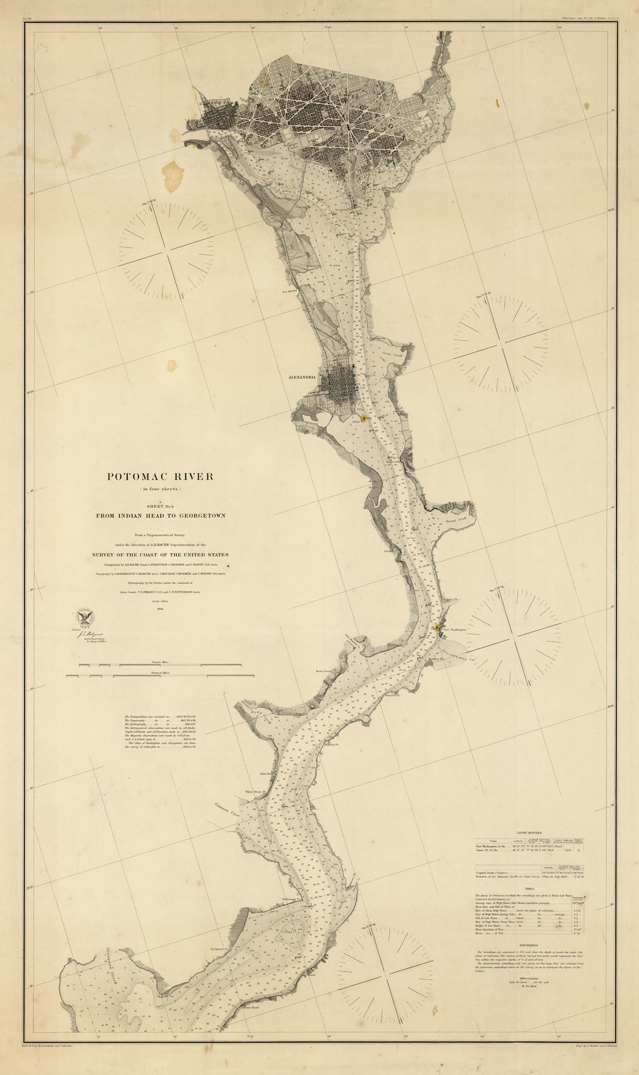
ARTIST: Alexander Bache
PUBLISHER: Published by the United States Coast Survey, Washington D.C.
MEDIUM: Engraving,
DATE: 1864
EDITION SIZE: Image size 38 x 22" (96.6 x 56 cm) plus margins.
DESCRIPTION: Highly detailed Civil War era sea chart of part of the Potomac River, including Alexandria and Washington D.C. north to Georgetown. This chart includes soundings and buoy locations throughout the river, and details the creeks, rivers, canals, harbors and railroad lines that branch farther inland. The northern half of the map also includes fine detail in the cities of Alexandria and Washington D.C., depicting their gridded streets and the major landmarks in the capital, such as the Capitol, U.S. Arsenal, Navy Yard, Smithsonian Institution, and the President’s House. Coastal terrain is drawn in varying textures, and additional information in the map describes tides and lighthouses.<br><br>Although this chart is the last in a four-part series, it is meant to stand alone instead of joining with the other three; it is drawn to a different scale and orientation.<br><br> Alexander Dallas Bache was the superintendent of the United States Coast Survey and the great-grandson of Benjamin Franklin. During his 22 years as superintendent, Bache oversaw the coast survey in its most productive period, working to create accurate and detailed charts of the nation’s harbors and coastlines.
ADDITIONAL INFO:
CONDITION: Good condition save for a small water stain in the image, left of DC.
REFERENCE:


 Login / Register
 Basket