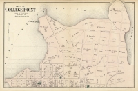
ARTIST: F. W. Beers
PUBLISHER: Published by F. W. Beers a& Co. New York.
MEDIUM: Stone engraving,
DATE: 1878
EDITION SIZE: Image 21 1/2 x 14 1/2" (54.7 x 37 cm).
DESCRIPTION: Two maps on one sheet. On one side is the township of Newport with an inset map of Derby Center. On the other side is a map of Derby Lane and the township of Derby. The maps are quite detailed, especially so with the village maps. Many homes and the owner’s names are given. This map appeared in Beers "Atlas of the Counties of Lamoille and Orleans Vermont."
ADDITIONAL INFO:
CONDITION: Good condition and color.
REFERENCE:


 Login / Register
 Basket

![Adams. [and] Hancock. [Towns of].](https://oldprintshop.com/uploads/jpg/24298_productthumb.jpg)