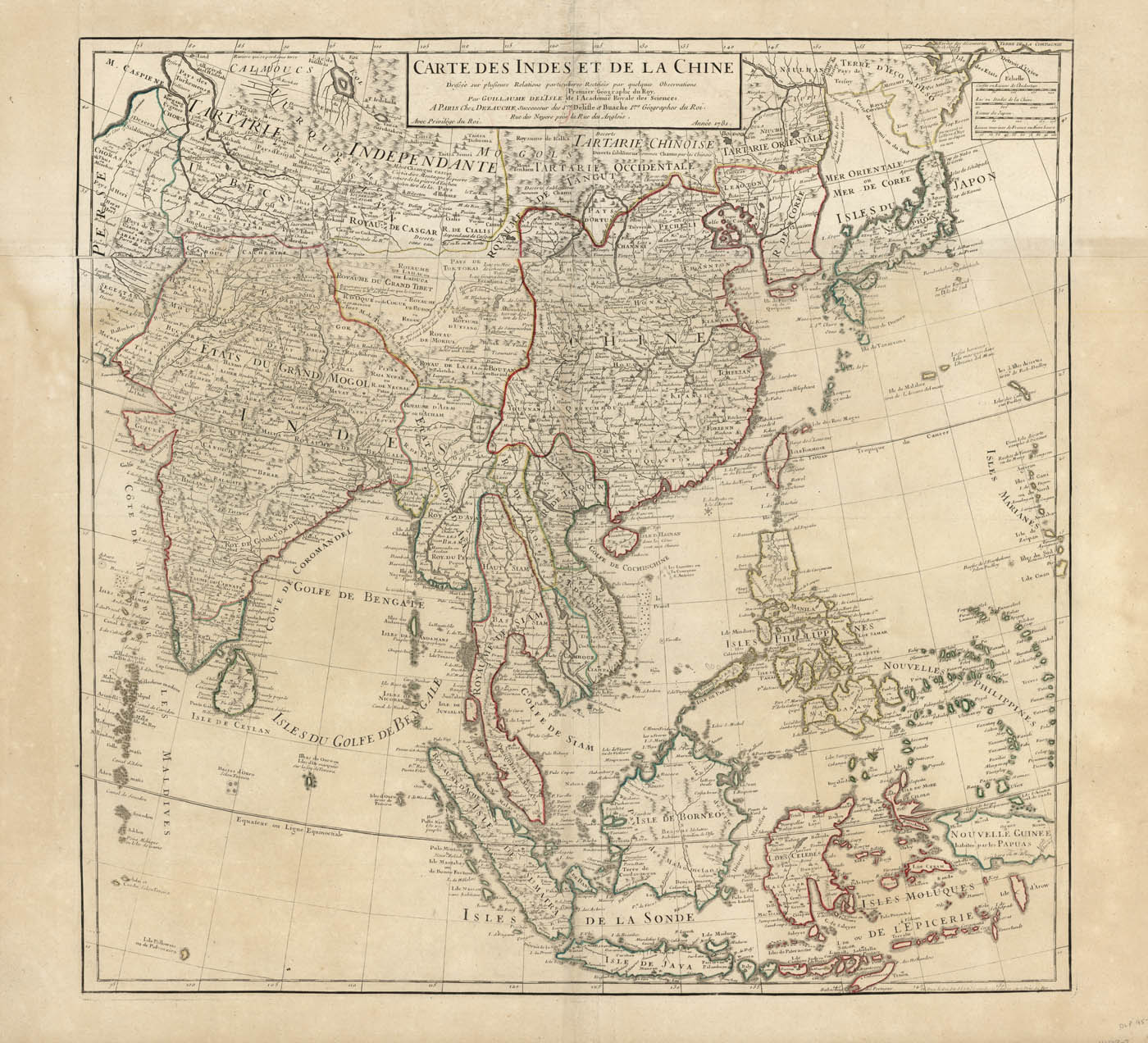
ARTIST: Guillaume De L'Isle
PUBLISHER: Published in Paris by J. A. Dezauche.
MEDIUM: Copper engraving; original outline color,
DATE: 1781.
EDITION SIZE: Two sheets joined, image 24 3/4 x 25 3/4" (63 x 65.5 cm).
DESCRIPTION: Delisle's map of eastern Asia extends from India across China to Japan and includes the East Indies and Philippines. Place names abound, making this map a fine example of expanding knowledge of Europeans about the area in the wake of the East India Company's activities there. Even in remote areas such as Tibet and Uzbekistan, towns, rivers and mountain are located and named. Korea is mapped correctly as a peninsula, although its outline is inaccurate. Part of New Guinea appears, but the map does not extend far enough south to include any part of Australia. This example published by Dezauche who was the successor to Buache and De L'isle.
ADDITIONAL INFO:
CONDITION: Overall good condition, some discoloration. Original outline color.
REFERENCE:


 Login / Register
 Basket