ARTIST: Pedro Vicente Maldonado
PUBLISHER: Published by Jean Francois de La Harpe, Paris.
MEDIUM: Copper plate engraving,
DATE: 1751 (c.1757).
EDITION SIZE: Image 23 x 13 3/4" (58.4 x 35 cm).
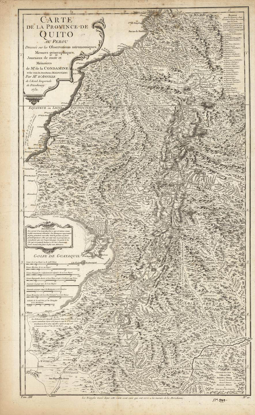
DESCRIPTION: The single sheet version of Pedro Vicente Maldonado's important four-sheet map of the Province of Quito. Focused on what is today Ecaudor, the map extends from Jaen on the Rio Maranon in what is now northern Peru, all the way northwards to Popayan (Colombia), and runs from the Pacific coast over the Andes to include the upper reaches of the Amazon Basin. This map appeared in Prevost's "L'Histoire Generale des Voyages". <br><br>
ADDITIONAL INFO: Manuscript number in lower margin "No. 299"
CONDITION: Good condition. B/W
REFERENCE:


 Login / Register
 Basket