ARTIST: Hermann Bollmann
PUBLISHER: Pictorial Map Company.
MEDIUM: Color offset.
DATE: 1936.
EDITION SIZE: Image 32 1/2 x 42 5/8" (82.6 x 105.8 cm)
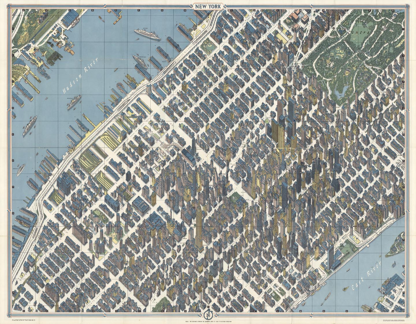
DESCRIPTION: A graphically stunning, axonometric map of midtown New York in the early 1960’s. The map shows an area from lower central Park southward to the very western edge of 12th street. The buildings are shown in remarkable 3-D detail. Fun places shown on the map: The original Pennsylvania Station, Pan Am building and the High Line. Many prominent businesses and buildings are identified such as Gimbles, Macy’s, B. Altman & Co., Rockefeller Center, The Daily News, ITT, Union Carbide, etc. Even the building that The Old Print Shop resides in is shown.<br><br> Hermann Bollmann (1911-1971) was a German cartographer who brought his training as a graphic artist to bear on the German tradition of Vogelschaukarten or bird's-eye-views. A version of this pictorial map of New York City was included as part of the "Official World's Fair Edition" map and guide for the 1964 World's Fair. For this map Bollman's staff designed and built special cameras and took over 67,000 photographs of the city, 17,000 of which were from the air. The actual drawing was done by hand and is very accurate although some features are exaggerated for clarity. The map was later promoted for use at the 1964-65 Worlds Fair.
ADDITIONAL INFO:
CONDITION: Good condition, save for some minor repaired splits along fold intersections.
REFERENCE:


 Login / Register
 Basket