ARTIST: Joan Blaeu
PUBLISHER: Published by Guiljelmum Blaeu, Amsterdam.
MEDIUM: Copper plate engraving,
DATE: 1640.
EDITION SIZE: Image size 15 1/8 x 19 1/2" (385 x 495 mm) plus margins.
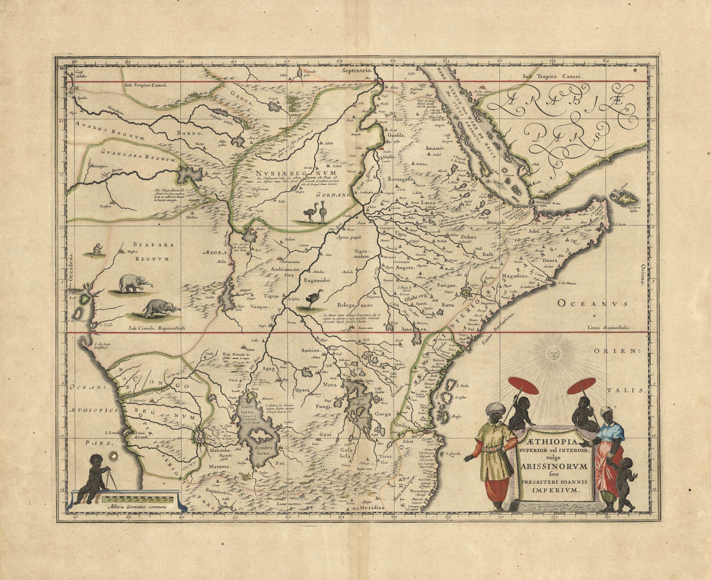
DESCRIPTION: This map covers an area of eastern and central Africa, including Mozambique north to present day Sudan, and it depicts the legendary Christian kingdom of Prester John. The myth of Prester John, derived from myths of the Crusades, supposed the existence of a fabled Christian kingdom headed by a king who would one day lead his forces to retake the Holy Land for Christendom. Prester John’s empire was at first assumed to be in India, but once exploration of the area did not reveal a kingdom, the myths moved it to Africa. The myth’s truth was seemingly confirmed in the 14th century, when exploration of east Africa revealed Christian kings in Ethiopia and Abysinnia. Scholars believed that the Coptic Ethiopian king David II was a descendant of the Prester John of legend, and maps of east Africa depicted the fictional kingdom in this area until the 18th century. <br><br>This map is modeled after Blaeu’s 1608 larger wall map of Africa. Much of its cartography is also based on earlier maps by Ptolemy and Ortelius; the Nile and the lakes of Zaire and Zaflan are modeled after Ptolemy’s geography, and it was Ortelius’ 1573 map of Prester John’s fictitious kingdom which inspired this map’s depiction of the region. Fabled rivers, elephants, ostriches, and monkeys fill the unexplored interior, making it a very handsome map. <br><br>
ADDITIONAL INFO: French text on verso.
CONDITION: Good condition save for overall time-toning. Small ore hole (foreign object in the paper) in lower left next to cherub. Original outline coloring.
REFERENCE:


 Login / Register
 Basket