PUBLISHER: Published by the Department of Highways and Public Works, Nashville.
MEDIUM: Stone engraving,
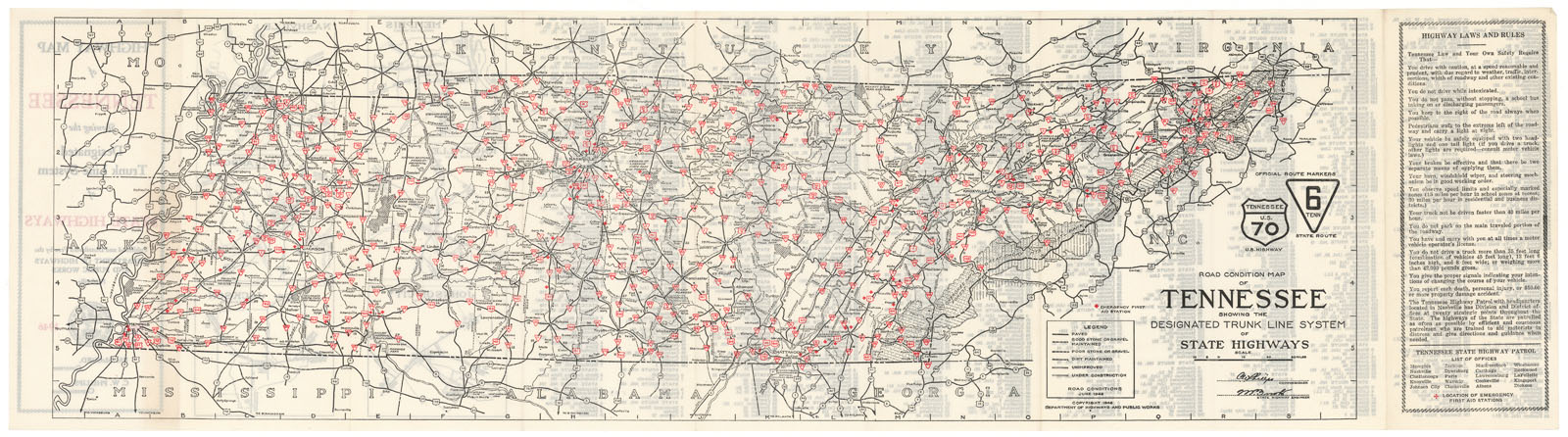
DATE: 1846.
EDITION SIZE: Sheet size 9 x 33 5/8" (23 x 85.3 cm).
DESCRIPTION: A fun early road map of the state. The legend notes paved roads, good stone or gravel, poor stone or gravel, dirt and unimproved. Official road markers are printed in red.<br><br> On the verso is a numbered index and six vignette maps, they are: Memphis, Knoxville, Johnson City, Nashville, Chattanooga and Jackson.<br><br> "Tennessee law and your own safety require the you drive with caution, at a speed reasonable and prudent...".
ADDITIONAL INFO:
CONDITION: Good condition.
REFERENCE:


 Login / Register
 Basket