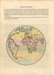
ARTIST: John Thomson
PUBLISHER: Published by John Thomson & Co. Edinburgh.
MEDIUM: Engraving,
DATE: 1819.
EDITION SIZE: Image size 8 3/4 x 11 1/2" (22 x 29 cm).
DESCRIPTION: This map appeared in "A General Atlas, Containing Maps illustrating some important periods in Ancient History and distinct maps of the several Empires, Kingdoms and States in the World,. From original drawings according to the latest Treaties by J Wyld. And Engraved by N.R. Hewitt."
ADDITIONAL INFO:
CONDITION: Good condition save for some soiling in the margins. Original outline color.
REFERENCE:


 Login / Register
 Basket