ARTIST: John Thomson
PUBLISHER: Published by John Thomson & Co. Edinburgh.
MEDIUM: Engraving, with hand colored outline,
DATE: 1819.
EDITION SIZE: Image 11 1/2 x 8 5/8" (29.3 x 22 cm).
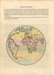
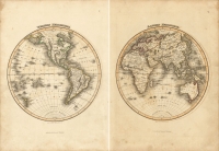
DESCRIPTION: Plate 34 from "A General Atlas, Containing Maps illustrating some important periods in Ancient History and distinct maps of the several Empires, Kingdoms and States in the World,. From original drawings according to the latest Treaties by J Wyld. And Engraved by N.R. Hewitt. A nicely detailed map of the continent of Africa,. I the early decades of the 19th century, Africa was largely unexplored by Europeans save for the colonies (British, Portuguese, Dutch, and Ottoman) scattered around the coastal perimeters. Within the interior of the continent, Thomson endeavored to identify the kingdoms, tribes, and nationals of the precolonial population.
ADDITIONAL INFO:
CONDITION: Good condition save for some faint toning and offset.
REFERENCE:


 Login / Register
 Basket