PUBLISHER: Published by the Fisheries, Game and Forest Commission, State of New York.
MEDIUM: Multi-color lithograph
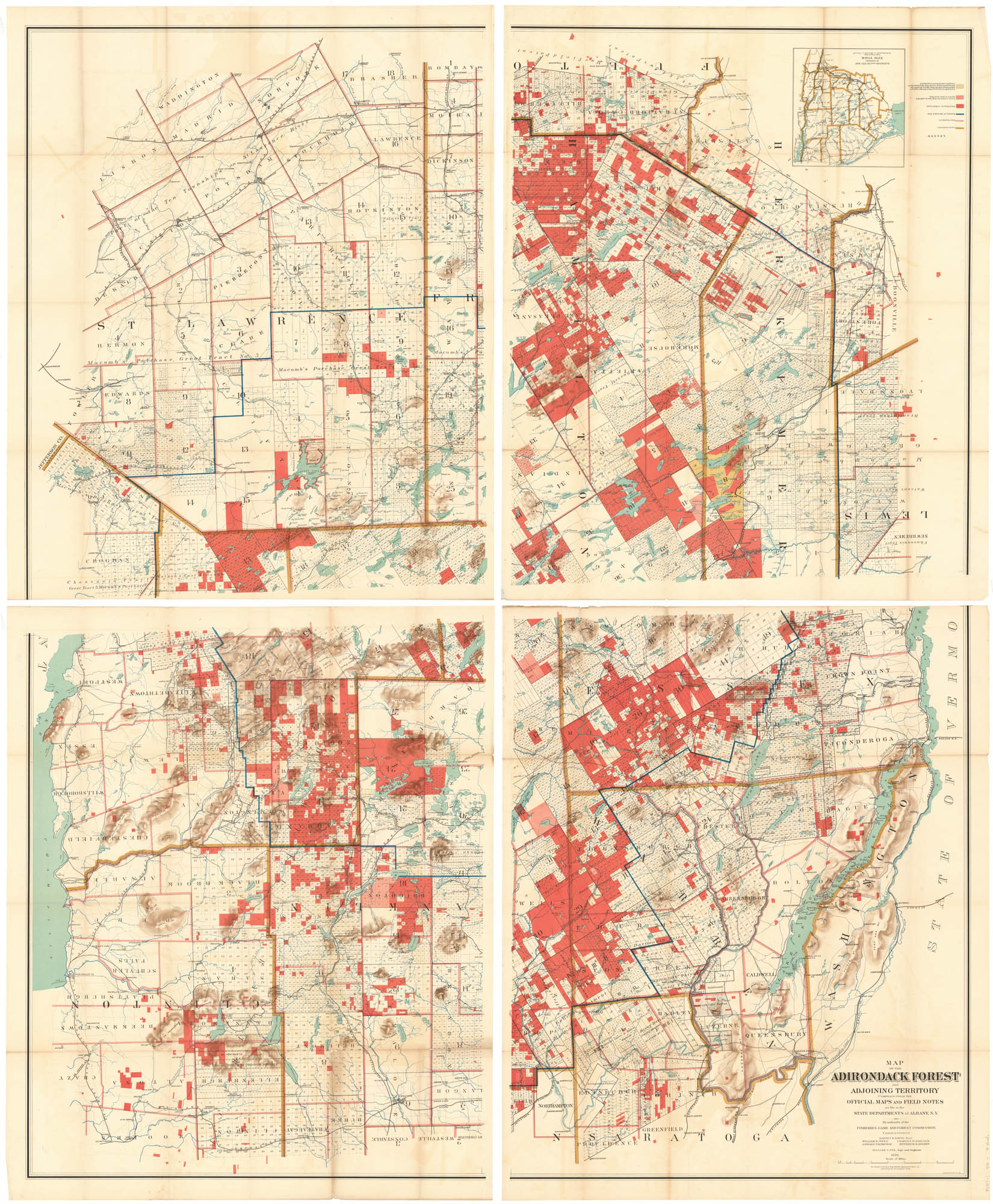
DATE: 1896.
EDITION SIZE: Four sheets, each measures: 36 x 29 1/2" (91.5 x 75 cm) If joined. overall 72 x 59"
DESCRIPTION: Lith of J. Bien & Co. N.Y.<br><br> An amazingly detail folding map of of the Adirondack Mountains in North Eastern New York State. Shows an area from Fort Edward to Rensom and northward. Shows and identifies the many creeks, rivers, lakes, ponds and mountains found here. A color coded legend notes the county boundaries, town boundaries, the boundary of Adirondack Park, Forest Preserve or state lands, land in which the State has an undivided interest, or joint ownership and lands dedicated permanently to forestry purposes... .
ADDITIONAL INFO:
CONDITION: Overall in very good condition and color.
REFERENCE:


 Login / Register
 Basket