PUBLISHER: Published by Hyde & Company, 97 Liberty St. Brooklyn Bouough.
MEDIUM: Lithograph, hand colored,
DATE: 1899.
EDITION SIZE: Image size 30 1/8 x 27 3/4" (76.5 x 70.3 cm).
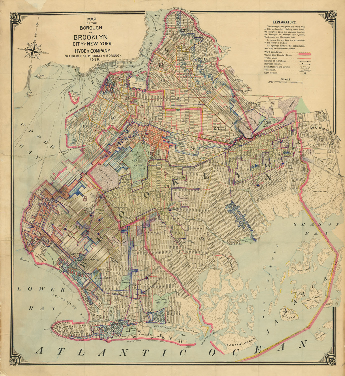
DESCRIPTION: A large and quite detailed map of the city of Brooklyn.<br><br> The key in the upper right notes ward boundaries (yellow) and council district boundary lines (heavy pink). Trolley lines (thin pink), than elevated railroads stations, steam railroads, fresh meadow and swamp, tide marsh, and lighthouses are also noted.<br><br> Ferry routes and piers are shown. On Coney Island the Brighton, Manhattan and Oriental hotels are shown. Also shown is the Brighton Beach race course, the Brooklyn Jockey Club and the Coney Island Jockey Club.<br><br> This map has several areas with manuscript notes and shading. It is our belief that it likely once belonged to a real estate developer. or city agency.
ADDITIONAL INFO:
CONDITION: Good condition and color save for some tattering along sheet edges.
REFERENCE:


 Login / Register
 Basket