ARTIST: Benjamin Norman
MEDIUM: Engraving
DATE: 1845
EDITION SIZE: Map size 18 x 24 1/2" (45.8 x 62.4 cm)
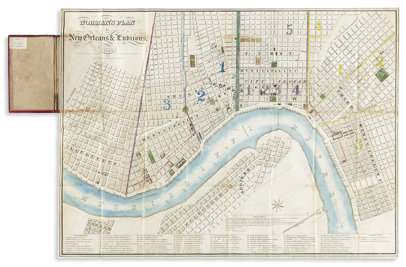
DESCRIPTION: A handsome hand colored engraved pocket map of New Orleans. This map was issued as a separately issued pocket map folded into the original 12mo format gilt-and-blind-stamped red roan case with gilt title that matches the map. Pasted on the inside front cover is Norman’s own label advertising his wares.<br><br> A series of concentric distance circles starting at the base of Canal Street and drawn at 1/4-mile interval to help give the reader an idea of distances. A numbered reference key identifies 71 prominent businesses, banks, markets, churches etc. within the city. .<br><br> An unrecorded state. .<br><br> Normally seen with credit given to Henry Moellhausen, this printing does not mention him. Although similar, upon close comparison, this and the Moellhausen imprint are printed from completely separate plates. Both are engraved by Shields and Hammond and dated 1845. One difference between the two is that this impression has unshaded lettering for “Norman’s Plan” in the title. The blocks that are nearest to the river are shaded, likely delineating those that are built upon. Both do note Norman as the publisher. .<br><br> Benjamin Moore Norman (December 22, 1809 – February 1, 1860) was an American book dealer and writer.<br><br> Norman was born in Hudson, New York, son to William E. Norman, a local bookseller. When his father died, the younger Norman left his clerkship in New York City to take over the family bookstore. Shortly after, he left Hudson for Philadelphia, only to move to New Orleans in 1837 where he opened up his own book, stationary and printing establishment.
ADDITIONAL INFO:
CONDITION: Very good condition and color.
REFERENCE:


 Login / Register
 Basket