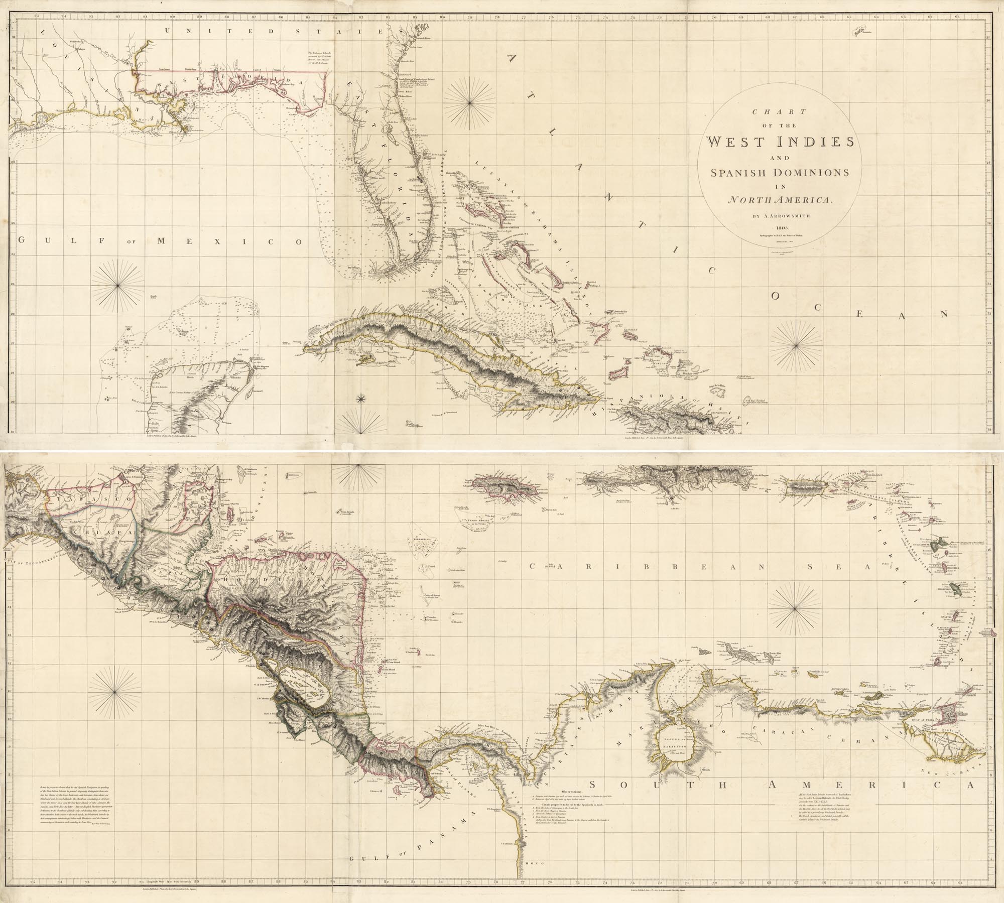
ARTIST: Aaron Arrowsmith
PUBLISHER: A. Arrowsmith, Hydrographer to H. R. H. Prince of Wales. No. 10 Soho Square, London.
MEDIUM: Copper plate engraving,
DATE: 1803-17.
EDITION SIZE: Four sheets joined to form two. Each 23 3/4 x 55 5/8"; overall 47 1/2 x 55 5/8" (121 x 141 cm).
DESCRIPTION: This fine large-scale chart was first issued in 1803 in a larger size (47 1/2 x 75"). In 1810 Arrowsmith reissued this reduced version, cutting approximately a quarter off the western portion of the plate, thus excluding most of Mexico. This was presumably done, as he published a more focused map of Mexico that year. Fine delineation in the Bahamas. Unrecorded edition with the statement "additions to 1810– 1817." Stevens & Tree only list two, 1803 and 1810. Phillips lists an 1811 (P-Maps) and an 1816 (atlases) edition.
ADDITIONAL INFO:
CONDITION: Good condition save for occasional paper repairs along folds and sheet edges. Original outline color.
REFERENCE: Stevens & Tree #89 (first and second states only).


 Login / Register
 Basket