ARTIST: Henry Tanner
PUBLISHER: Published by H. S. Tanner, Philadelphia.
MEDIUM: Engraving,
DATE: 1829.
EDITION SIZE: Large case map. 45 3/4 x 60 5/8".
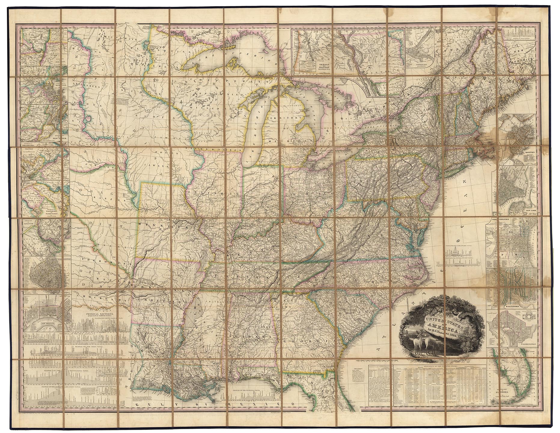
DESCRIPTION: "Tanner undertook the ambitious task of compiling a large map, the United States of America, which he copyrighted on June 10, 1829. It is at a scale of 1:2,000,000, somewhat larger than Melish's 1816 map of the United States. Melish's map, however, extends westward to the Pacific Ocean, whereas Tanner's map terminates just west of the upper course of the Missouri River. Tanner's the United States of America has thirteen inset maps, principally of cities and their environs, a statistical table, and profiles of several canals and railroad rights of way…" The main map is surrounded by inset maps of fourteen cities, South Florida, Oregon and the Mandan Districts (with a chart of the Outlet of Oregon River), two statistical tables, and fourteen profiles of portages, canals, and railroads. Latitude is measured from Washington, D.C., making this a truly "American" map. "This is one of the best early large maps of the United States and the premier map for its period." David Rumsey. The map was engraved by Tanner with assistance by E.B. Dawson, and W. Allen. The title cartouche, which pictures a country landscape with two deer in the foreground, was engraved by J.W. Steel. A very fine copy in a case map format.
ADDITIONAL INFO:
CONDITION: Good condition and color. New case and linen backing.
REFERENCE: Phillips Maps p.885; Howes T28; Ristow p.198.


 Login / Register
 Basket