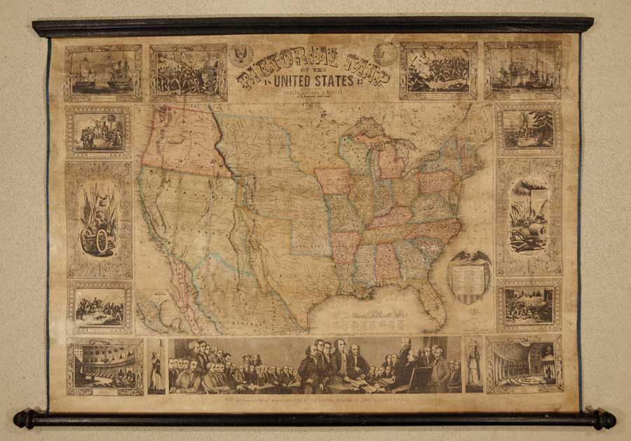
ARTIST: John Atwood
PUBLISHER: Published by Ensign and Thayer, N.Y.
MEDIUM: Handcolored engraving,
DATE: 1847-48.
EDITION SIZE: Image size, 28 1/8 x 39 3/4" (71.5 x 101 cm) plus margins.
DESCRIPTION: A decorative wall map of the United States from coast to coast. The newly formed state of Texas is shown with its "stove-pipe" configuration, claiming the lands of the upper Rio Grande. Nebraska is shown as a large area that includes Colorado, Montana, and the Dakotas. The map is surrounded with American historical images such as the Battles of Lexington, Bunker Hill, and Monterey. Interior scenes of the Senate and House of Representatives and a large lower central image showing the signing of the Declaration of Independence.
ADDITIONAL INFO:
CONDITION: Gererally in good condition. Restored and backed onto new linen.
REFERENCE:


 Login / Register
 Basket