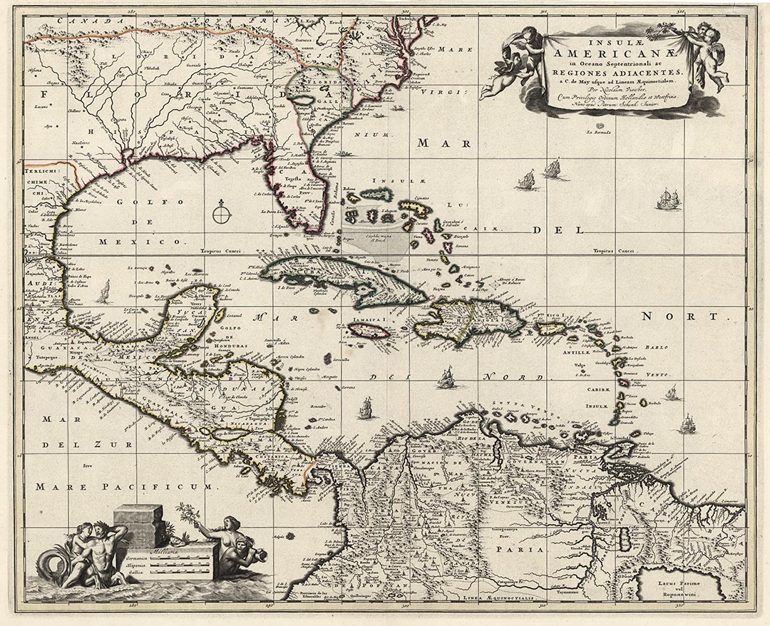
ARTIST: Nicolaes Visscher
PUBLISHER: N. Visscher, Amsterdam.
MEDIUM: Handcolored copper plate engraving,
DATE: c.1680.
EDITION SIZE: Image size 18 1/8 x 21 7/8" (45.5 x 55.6 cm) plus margins.
DESCRIPTION: A beautifully engraved map of the Caribbean. It is nicely embellished with a very decorative title cartouche that is supported by cupids and the scale cartouche is supported by Mermaids and a Merman. The map extends from Cape May, New Jersey to the Equator and Embraces the whole of the Gulf of Mexico, Central America, the West Indies and part of South America.
ADDITIONAL INFO: Third state of four.
CONDITION: Very good condition. Original outline hand coloring.
REFERENCE: #531 in "Mapping of North America II" by Philip Burden


 Login / Register
 Basket