ARTIST: James Wyld
MEDIUM: Copper plate engraving,
DATE: Undated, c.1841.
EDITION SIZE: 23 3/4 x 36 1/2" (603 x 927 mm) plus margins.
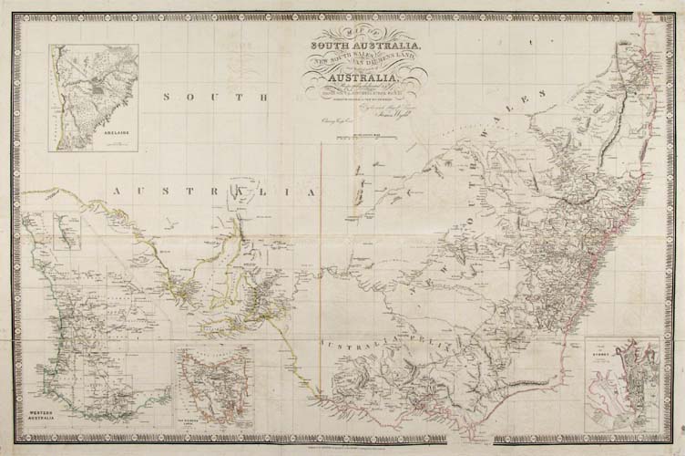
DESCRIPTION: Likely the most accurate survey to date. This map is dedicated Sir T. L. Mitchell Kt. D.C.L F.G.S &c. Surveyor General of New South Wales. This map is from Wyld's "A New General Atlas of Modern Geography…". Wyld succeeded William Faden and Thomas Jeffreys as "Geographer to the Queen." His maps are known for their high quality engraving and attention to detail. The four insets are of Western Australia, Van Diemans Land, the city of Adelaide and a plan of Sidney. This map is quite large and folded out of the atlas, Wild segmented the lower third and backed it with linen for easier folding.
ADDITIONAL INFO:
CONDITION: Good condition save for some offsetting. Original outline color.
REFERENCE:


 Login / Register
 Basket