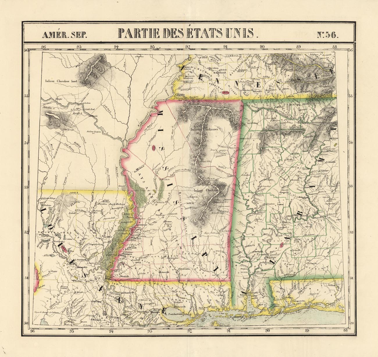
ARTIST: Philippe Vandermaelen
PUBLISHER: Published by P. Vandermaelen, Belgium.
MEDIUM: Lithograph handcolored,
DATE: 1827.
EDITION SIZE: 18 3/8 x 22" (468 x 560 mm) plus margins.
DESCRIPTION: Plate No. 56 from "Atlas Universelle". A beautiful map of Mississippi and Alabama with parts of Louisiana, Arkansas and Tennessee. This atlas was the first published lithographic atlas. A bright and well-colored example.
ADDITIONAL INFO:
CONDITION: Very good condition. Fine period handcoloring.
REFERENCE:


 Login / Register
 Basket