ARTIST: J. Henshall
PUBLISHER: London; Chas. Knight & Co. 22, Ludgate Street, under the superintendence of the SDUK.
MEDIUM: Handcolored engraving,
DATE: c.1844-52.
EDITION SIZE: 13 1/8 x 15 3/4" (33.3 x 40 cm) plus narrow margins.
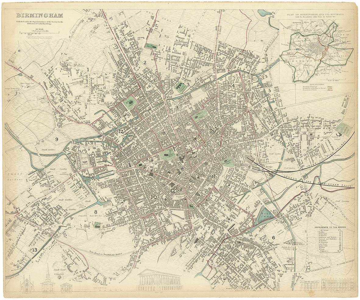
DESCRIPTION: There is a reference to the wards of the city and a scale comparison of important buildings along the bottom. There is also an inset of the "Plan of Birmingham and its Environs.<br><br> The Society for the Diffusion of Useful Knowledge, better known as SDUK, was an English enterprise devoted to spreading the most up to date cartographic information and enhancing geographical understanding and knowledge of the world. Over a period of years, the maps that the SDUK produced were issued by various publishers. The following is a breakdown. Baldwin & Craddock, 1829-32. Chapman & Hall, 1844. C. Knight, 1844-52. G. Cox, 1852-3. Stanford, 1857-70. The maps from this series are known for their fine engraving and attention to detail. This map of Birmingham, England shows all roads, waterways, and important buildings.
ADDITIONAL INFO: This issue is without Chas. Knight imprint.
CONDITION: Good condition with original wash color and the usual narrow margins.
REFERENCE:


 Login / Register
 Basket